C. Regional data collection sites
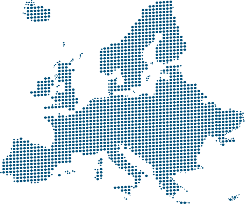
NitroScope includes more than 100 regional data collection sites that form the project’s spatial backbone, ensuring broad coverage of Europe’s soils, climates, land uses and farming systems. These sites are distributed across eight major pedo-climatic regions—from Boreal and Alpine South to Mediterranean North and South—capturing the full variability that shapes nitrogen dynamics at regional and continental scales. Unlike the pilot and intensive monitoring sites, regional data collection sites prioritise coverage and representativeness, enabling NitroScope to move from local observations to Europe-wide assessments.
Regional sites are well-established research locations where monitoring infrastructure and data collection protocols are already in place. They include arable land, grasslands, horticultural systems, agroforestry (e.g. Montado), orchards, forestry and mixed land-use systems, with field sizes ranging from 0.5 to 1,200 hectares. Soil types span sandy loam, loam, clay and clay loam, including special cases such as rewetted peatlands, with soil organic carbon contents ranging from below 1% to over 40%. This diversity allows NitroScope to quantify how nitrogen fluxes respond to contrasting environmental and management conditions across Europe.
Monitoring at regional data collection sites is conducted over three growing seasons, following harmonised protocols that ensure data comparability while allowing flexibility in instrumentation depending on local infrastructure. All sites measure standard soil properties—including texture, bulk density, porosity, pH, electrical conductivity, organic carbon and nutrient status—while the majority also monitor soil nitrate, soil moisture and temperature, mineralisation rates and salinity. At least half of the sites collect meteorological data and greenhouse gas emissions (N₂O, CO₂ and CH₄), providing the minimum dataset required to characterise nitrogen cycling under real farming and land-use conditions.
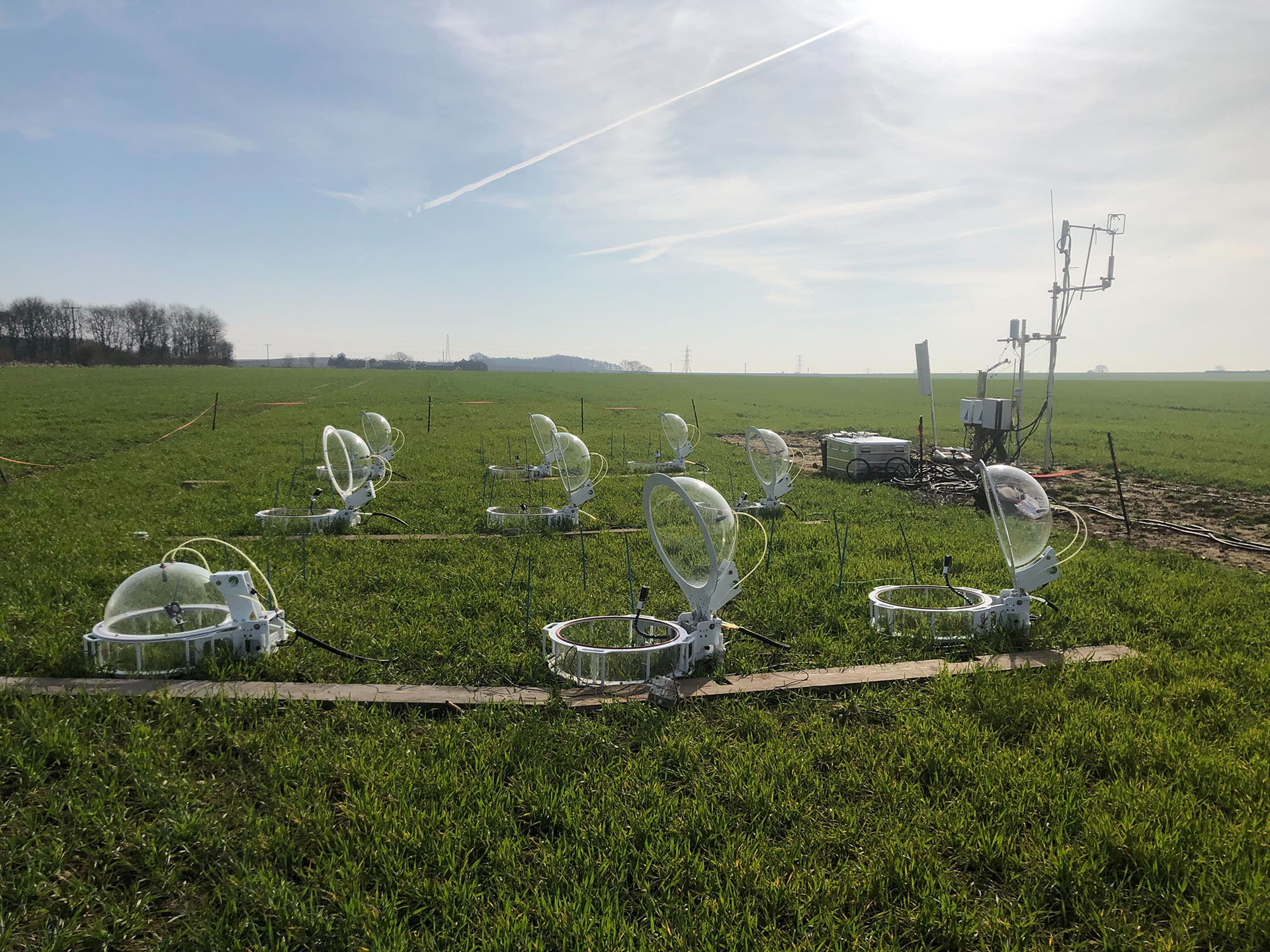
These sites make extensive use of proximal sensing, soil sampling and remote sensing technologies, including suction cups for nitrate and ammonium, automatic and manual gas chambers, autonomous weather stations, multispectral and hyperspectral drone imagery, satellite data, and—where available—eddy covariance towers. Rather than maximising instrumentation at individual locations, NitroScope deliberately increases the number of monitored sites, allowing the project to capture spatial variability and reduce bias caused by site-specific conditions.
Regional data collection sites play a critical integrative role in NitroScope. The harmonised datasets they generate are used to calibrate and validate nitrogen flux models, derive region-specific emission factors, and quantify uncertainty across pedo-climatic zones. Crucially, these sites enable the upscaling of field-level nitrogen fluxes—including nitrate leaching and gaseous emissions—to national and European nitrogen budgets. By bridging the gap between intensive process studies and large-scale modelling, regional data collection sites ensure that NitroScope’s outputs are robust, representative, and directly relevant for EU-level policy, reporting and scenario analysis.
Regional data collection sites are distributed across Europe’s main pedo-climatic zones.
See also...
Α. Pilot sites
Five pilot sites test improved nitrogen management and conservation strategies under real field conditions. Monitored over two growing seasons across different pedo-climatic zones, they link practices to impacts on NUE, crop performance and nitrogen losses.
B. Intensive monitoring sites
Nine intensive monitoring sites provide continuous 24/7 measurements over about 24 months, starting in February 2027, capturing short-term variability in nitrogen fluxes. They monitor soil nitrogen, gaseous emissions, soil conditions and crop dynamics to generate reference datasets and reduce modelling uncertainty.
C. Regional data collection sites
Around 100 regional data collection sites ensure broad coverage of Europe’s soils, climates and cropping systems. Their harmonised, multi-season datasets support model calibration, regional comparison and upscaling to national and EU levels.